Pearl River One Lake Sponsors Keep Information Tight as Final Project Review Begins
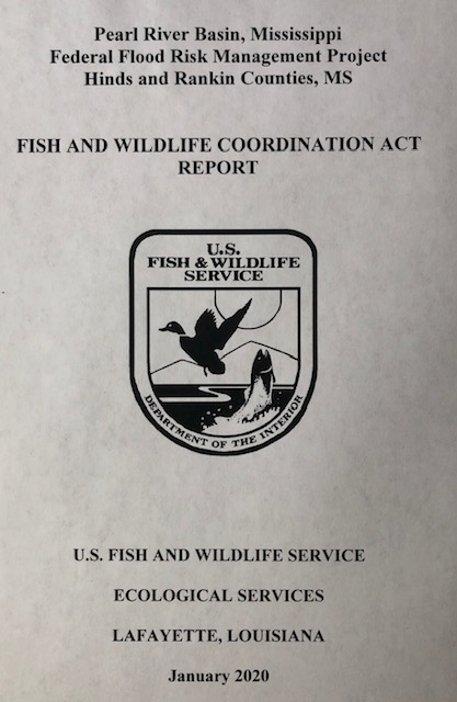
A recently released document from the U.S. Fish and Wildlife Service goes into detail about why a lake dredging alternative for flood control on the Pearl River in Jackson Mississippi is the most environmentally damaging alternative the project sponsor could choose. Yet it is pushing this plan forward for approval by the Army Corps of Engineers.
Pearl River One Lake Sponsors Keep Information Tight as Final Project Review Begins Read More »