Help us Look Out for the Land! Seeing something can change it.
Thanks to the work of over 650 participants making over 20 thousand unique assessments of wetland images, we have been able to analyze 454 square miles of land for 6 different types of land loss. One year into the project, we have recruited over 1000 “lookouts” to the cause. Will you be the next? Join us today! https://cartosco.pe/landloss
Thanks to Caroline Nickerson, Miss Louisiana Earth, and SciStarter for all of their assistance!
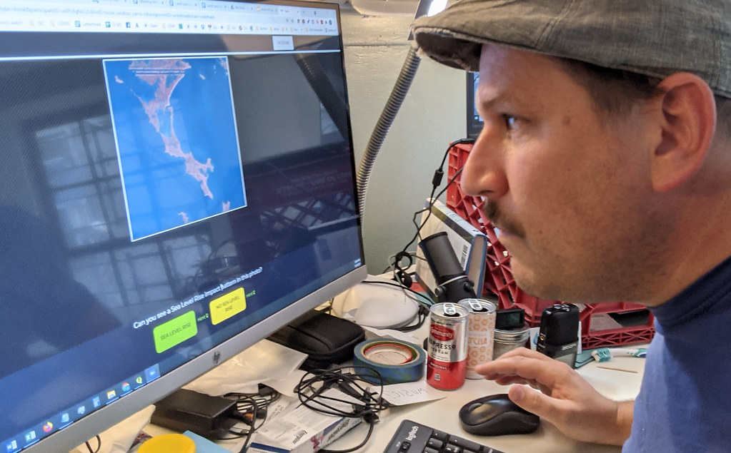
In this first phase, we were assessing how well participants’ analyses compared to trained experts. Participants’ contributions were remarkably consistent. Six expert assessments of the same image sets, reaching over 90% agreement in many cases, and over 80% in most cases. We also found that in the smaller set of images where participants were uncertain or disagreed a lot with each other, experts also struggled with image identification. Disagreement occurs in less than 12% of the images assessed This means we know the images where all participants disagree with each other, and we can pass them efficiently back to experts for further review..
Based on these results we can confidently expand this project to look at different time periods.
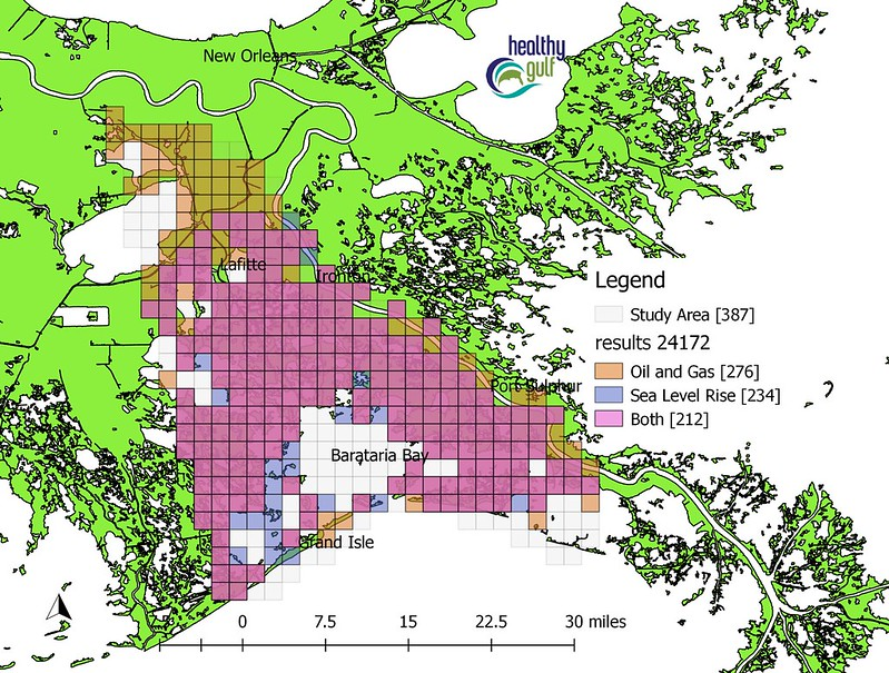
It is important to continue looking, because the most frequently identified patterns of land loss were land loss due to oil and gas well canals and sea level rise. These patterns were identified in 62% of images and co-occurred 77% of the time.
This co-occurrence makes sense because oil and gas canals and sea level rise create the same pattern of land loss, a pattern of many small, circular pools in the middle of the lowest-lying marsh land.
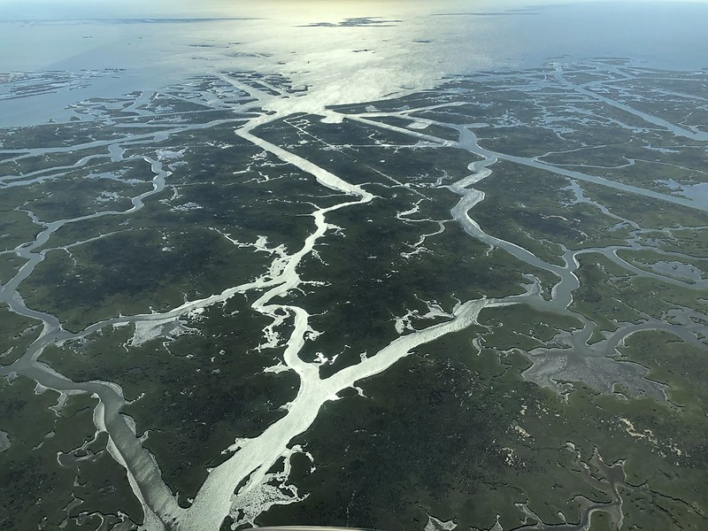
Oil and gas canals produce this “waterlogging” of marsh because the canals prevent proper marsh drainage locally. The higher seas prevent proper drainage regionally. When tidal waters cannot drain during the growing season, the marsh dies and turns to water. As sea level rises, our wetlands need to drain more and more often! Unfortunately, the local problem caused by oil and gas makes a global and regional problem worse locally.
Though it can be hard, if not impossible, to separate which cause is the “primary” cause of any particular piece of land loss, the debate is unnecessarily academic–reducing fossil fuel production, and fixing broken fossil fuel infrastructure, can reduce both marsh stressors.
In this next Land Loss Lookout project we will be looking at images from 2008, so we can say how much marsh waterlogging, or any other impact pattern, has increased in the past 10 years.
Your observations make a difference! While we have been working, Federal agencies have started to press companies to assess the climate impacts of their projects, in Plaquemines, Terrebonne, and other places across the USA.
Thanks for Looking out! Join Land Loss Lookout today!
Scott Eustis is Healthy Gulf’s Community Science Director
Sara Wylie is an Associate Professor in Sociology and Health Science at Northeastern University